Heat and smoke return as wildfires burn across southern Interior
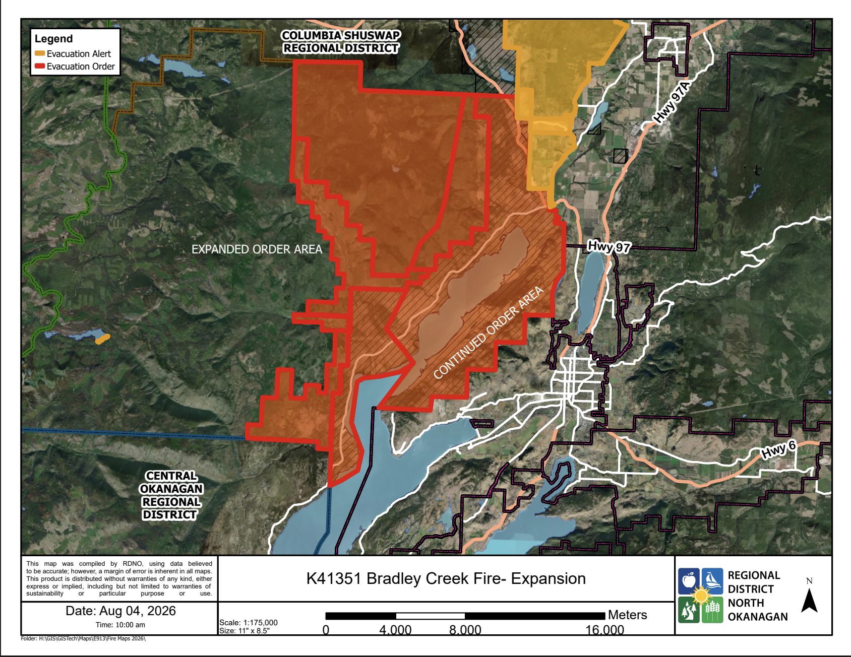
Map showing wildfire evacuation order and alert areas along Westside Road near Okanagan Lake.
Submitted photo.
No wildfire evacuation notice is in effect in the Boundary, while two alerts remain farther north in the West Kootenay and thousands of Okanagan properties are still under evacuation order.
Grand Forks residents are facing several days of increasing heat and wildfire smoke as fires continue to burn across the southern Interior.
The forecast calls for a high near 36 C Wednesday, rising to approximately 38 C Thursday and 39 C Friday. Hazy and smoky conditions are expected to continue, with the smoke potentially producing very poor air quality and reduced visibility.
The BC Wildfire Service dashboard listed 139 active wildfires across the province Wednesday morning. Of those, 56 were classified as out of control. The dashboard also showed 21 fires started and 20 declared out during the preceding 24 hours.
Wildfire burning in Gladstone Provincial Park
The nearest out-of-control wildfire being tracked in the Grand Forks area is the Hooper Creek fire in Gladstone Provincial Park, northwest of Highway 3.
The fire is believed to have been caused by lightning. Its reported size changed during recent updates, so the Boundary Sentinel has not included a hectare estimate in this report. The BC Wildfire Service’s live incident map should be consulted for its latest mapped size and response information.
No wildfire evacuation order or alert for the Regional District of Kootenay Boundary was listed by EmergencyInfoBC as of approximately 10 a.m. PDT Wednesday. Highway 3 also remained open through the Grand Forks and Christina Lake area.
Two West Kootenay evacuation alerts remain
The latest formal update from the Regional District of Central Kootenay, issued at noon Tuesday, said two evacuation alerts remained in effect: one for the Poplar Creek wildfire north of Kaslo and another for the Inonoaklin Creek fire northwest of the Needles ferry.
At the time of the bulletin, the RDCK said 56 wildfires were burning in the Southeast Fire Centre, including 29 classified as out of control.
The Poplar Creek wildfire was listed at 162 hectares in that update. It was discovered July 26 and is burning approximately 60 kilometres north of Kaslo. Crews and helicopters were working to limit its spread, and an area restriction remained in effect around the fire.
The Inonoaklin Creek fire was listed at 1,223 hectares. The RDCK said crews, helicopters and heavy equipment were responding, while an evacuation alert and area restriction remained in place.
A newer RDCK wildfire bulletin had not been posted by approximately 10 a.m. Wednesday. Fire sizes shown on the live BC Wildfire Service map may therefore be more recent than the figures in the regional district’s Tuesday bulletin.
Thousands remain evacuated along Okanagan Lake
The largest continuing evacuation in the southern Interior is connected to the Quilpituk Creek wildfire along the west side of Okanagan Lake.
Central Okanagan Emergency Management said Tuesday that evacuation orders remained in effect for 2,223 properties, with another 425 properties under evacuation alert. The fire was listed at 742 hectares and out of control. Westside Road remained closed north at Caesars Landing.
The emergency operations centre said Tuesday evening that the orders and alerts would remain in effect overnight. Emergency Support Services reopened at the Westbank Lions Community Centre at 9 a.m. Wednesday.
Farther north, the Bradley Creek wildfire remained out of control and was estimated at 2,852 hectares in the City of Vernon’s latest update. The BC Wildfire Service had reported no significant growth at the time of that update.
The Regional District of North Okanagan expanded an evacuation order Tuesday for properties in Electoral Area B because the Bradley Creek and Quilpituk Creek fires were affecting available escape routes along Westside Road.
The regional district emphasized that the newly added properties were not facing an immediate wildfire threat. The expanded order was intended to provide access to emergency support and safer travel through an area between two active fires.
More than 30 structures confirmed lost
The Okanagan Indian Band confirmed Tuesday that more than 30 structures had been lost in the Bradley Creek wildfire.
That figure is not final. The band said the number was expected to increase significantly as crews gained safe access to additional areas. Some areas remained inaccessible because of active fire, hazardous trees, damaged infrastructure and downed power lines.
All evacuation orders covering Okanagan Indian Band Reserve No. 1 remained in place Wednesday. A do-not-consume water advisory also continued for affected community water systems because fire damage had not yet been fully assessed. Boiling the water does not make it safe under that advisory.
The City of Vernon reported that its Emergency Support Services program registered 755 people from 366 households in person between Aug. 1 and Aug. 4. Another 685 people from 325 households registered online.
People who registered online and later attended the reception centre were counted only in the online category and were not duplicated in the in-person total. Approximately 50 volunteers a day were assisting with the response.
Wildfire sizes, road conditions and evacuation boundaries can change quickly. Residents should confirm current conditions through the BC Wildfire Service, EmergencyInfoBC, their regional district and DriveBC.
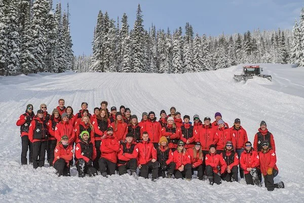









Big White Ski Resort and the Canadian Ski Patrol’s Ogopogo Zone have received separate 2026 awards from the patrol’s Pacific South Division.