RDKB updating decades-old floodplain maps in Rural Grand Forks, West Boundary
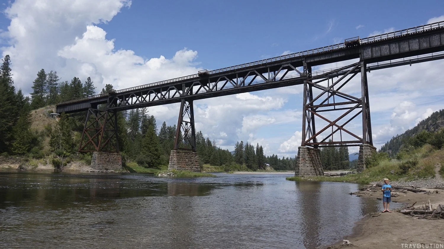
The Kettle River passes beneath a former railway bridge in Grand Forks, B.C. The RDKB is developing new floodplain and alluvial-fan mapping for Rural Grand Forks and West Boundary.
Photo credit: World of Travolution / Wikimedia Commons
Some floodplain maps still used under the Regional District of Kootenay Boundary’s current bylaw date to 1992 and 1997, as the regional district develops new mapping for Rural Grand Forks and the West Boundary.
The RDKB is developing new floodplain and alluvial-fan mapping for Electoral Areas D/Rural Grand Forks and E/West Boundary under a $400,000 provincial grant. The work covers priority areas along the Kettle, West Kettle and Granby rivers that remained to be mapped after the previous grant-funded update.
Residents in Area E can attend a draft floodplain mapping public engagement session Wednesday, Sept. 9, from 3 to 7 p.m. at the Westbridge Community Hall, 2935 Highway 33.
The current work follows a broader Boundary mapping effort launched after the 2018 flooding. A flood and geohazard risk assessment completed in 2020 identified areas where updated information was needed, and subsequent grant funding was used to map several priority reaches.
RDKB records identified three areas still requiring work: the Granby River north of Grand Forks, the Kettle River from Rock Creek toward Fiva Road, and the West Kettle River from its confluence with the Kettle upstream past Rhone.
Some of the existing regulatory mapping in those areas is decades old. The RDKB’s current Floodplain Management Bylaw incorporates mapping from 1992 for portions of the Granby River and 1997 mapping for the Kettle River between Rock Creek and Westbridge.
Other Boundary reaches were updated in 2023, including Rock Creek to Midway, Carson to Cascade Falls, Christina Lake and the Kettle River, and the West Kettle River between Carmi and Beaverdell.
The regional district has said floodplain maps are generally expected to be updated every 10 to 20 years or following a major flood event.
The maps also have a regulatory role. RDKB’s floodplain bylaw establishes setbacks, minimum flood construction levels and restrictions that apply in mapped flood hazard areas.
A 200-year floodplain represents land with a 0.5 per cent chance of flooding in any given year. The bylaw also includes provisions for floodways, high fluvial hazard areas and setbacks from rivers and other watercourses.
When the province announced funding for the current project in 2025, it said Areas D and E had been identified through earlier risk assessments as requiring updated mapping that incorporates climate-change forecasting.
Natural Resources Canada published a national report on Sept. 3 examining how climate change is being incorporated into flood-hazard mapping, including a case study of the RDKB’s previous Boundary project completed in 2023.
That earlier work examined reaches of the Kettle and West Kettle rivers and Christina Lake and incorporated future climate conditions into the flood modelling. The federal case study describes how climate projections were used to adjust design flows and account for potential changes in the timing and nature of future flood events.
The new Area D and E mapping is also being developed with climate-change forecasting as part of the provincially funded project.
RDKB has previously said updated floodplain maps are used for permitting only after the Floodplain Management Bylaw is amended, endorsed by the Board and updated by the regional district.
The Sept. 9 Westbridge session will give Area E residents an opportunity to learn more about the draft mapping before that process moves forward.


A historic mine opening near Rossland’s Kootenay Columbia Trail will be permanently sealed, with a three-week trail closure beginning Sept. 28 so crews can complete the work.