Residents return as wildfire restrictions ease across southern Interior
Evacuation orders are being downgraded and access is reopening around several fires, but officials warn burned areas remain hazardous and some communities are only beginning to assess their losses.
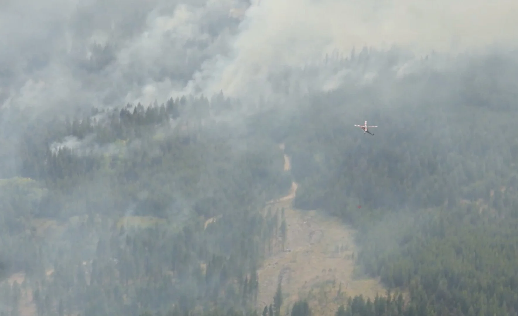
Bald Range wildfire remains out of control.
Photo: BC WIldfire Service
Residents are returning to wildfire-affected communities across southern British Columbia as evacuation orders and access restrictions begin to ease, even as some fires continue to burn and recovery crews work through damaged neighbourhoods.
The shift is particularly visible in the Okanagan, where residents have been allowed back into parts of Summerland, Peachland, the Okanagan Indian Band and communities along Westside Road.
Closer to the West Kootenays, BC Wildfire Service is also reopening access around the Mount Rollins wildfire southeast of Needles after fire behaviour decreased.
The return home does not mean conditions have returned to normal.
People entering burned areas are being warned about unstable trees, hidden ash pits, smoke, damaged infrastructure and other hazards that can remain long after the most intense fire activity has passed.
Bald Range remains out of control
The Bald Range wildfire remained out of control Monday at an estimated 21,256 hectares.
More evacuation orders around Summerland were downgraded Sunday, allowing residents to return to Trout Creek west of Highway 97, areas east of Highway 97 from McDougald Road south, and the area from Greata Ranch south to Summerland east of the highway.
An evacuation order remains in effect west of Highway 97 and for Callan Road, according to the Regional District of Okanagan-Similkameen.
Residents returning to fire-affected areas have been warned to expect ash, soot, smoke, damaged vegetation and potentially hazardous trees. Those who remain under evacuation alert are being told to keep emergency supplies ready in case conditions deteriorate and another evacuation becomes necessary.
A boil-water notice remains in effect for Trout Creek west of Highway 97 and the area east of Highway 97 from McDougald Road south.
The full extent of property losses from Bald Range has not yet been publicly tallied.
Homes and other properties have been destroyed, but officials have not yet released a consolidated damage count as assessments continue and affected property owners are contacted.
One death has been linked to the fire.
RCMP said an 80-year-old Meadow Valley resident died while attempting to leave the area with a family member on Aug. 7. Police said her death was believed to have resulted from the wildfire. The BC Coroners Service is investigating.
The damage picture has been different on the Peachland side of the fire.
Residents were allowed to return to evacuated areas there Friday, and Central Okanagan Emergency Management reported no structural losses in Peachland or the affected portion of Central Okanagan Electoral Area West.

Okanagan Indian Band residents return after major losses
Farther north, more residents of the Okanagan Indian Band have been allowed home as conditions improve on the Bradley Creek wildfire.
The fire is classified as being held at approximately 2,658 hectares.
Okanagan Indian Band Chief Dan Wilson estimated earlier this month that about 230 homes had been destroyed, including approximately 30 homes belonging to band members and 200 non-band homes. A final community-wide loss assessment has not yet been released.
Residents returning to the area have been warned that neighbourhoods may look dramatically different and that hazards can remain even around homes that survived.
Officials have advised people to watch for damaged trees, ash, debris, fallen utility lines and other hazards and to use protective equipment while cleaning up.
Water-quality advisories remain in place for the Six Mile, Bradley Creek, Irish Creek and Head of the Lake water systems.
Westside Road between Komasket Road and Simla Road reopened to local through traffic Sunday night, but motorists are being told to remain on Westside Road and keep moving through the area.
The road reopening does not lift evacuation orders that remain in place for affected properties.
Westside Road communities also reopen
Residents displaced by the Quilpituk Creek wildfire have also returned to communities farther south along Westside Road.
The fire is classified as being held.
Evacuation orders affecting communities from Cinnabar Creek through Westshore Estates were downgraded Friday, allowing residents in communities including Fintry, La Casa, Killiney Beach and Westshore Estates to return.
Central Okanagan Emergency Management reported no structural losses from the Quilpituk Creek fire.
Residents have nevertheless been warned about ash, smoke residue, debris, burned vegetation and dangerous trees, while firefighters continue patrolling the fire area and extinguishing hot spots.
The north end of Westside Road also reopened Sunday night.
Mount Rollins restriction lifted Monday
Access is also reopening around the Mount Rollins wildfire, about 11 kilometres southeast of Needles.
BC Wildfire Service said Monday that fire behaviour and activity had decreased enough that crews no longer needed to restrict public access to the area.
The area restriction imposed Aug. 10 was rescinded at noon Aug. 17.
The wildfire, identified as N51257, is estimated at 236 hectares.
BC Wildfire Service cautioned that the fire remains an active worksite and significant hazards may still be present.
Fire-damaged trees can become unstable and fall without warning, while ash pits can be difficult to detect and may remain hot long after visible flames have disappeared.
Smoke may also continue to rise from within the fire perimeter for several weeks.
BCWS said smoke coming from burned material well inside the perimeter is common, but smoke rising from green, unburned vegetation or from outside the known fire perimeter should be reported immediately.
Although the formal area restriction has been lifted, wildfire officials retain the authority to order people out of the area if conditions require it.
No current emergency activation in the Boundary
There were no current emergency activations listed by the Regional District of Kootenay Boundary Monday.
That does not mean wildfire risk has passed.
Crews continue to respond to fires across the southern Interior, and smoke from fires both near and far continues to affect communities throughout the Boundary, West Kootenays and Okanagan.
The changing evacuation picture marks a new phase of the fire season for several communities.
For some residents, going home means returning to an intact house and beginning to clean ash from decks, vehicles and gardens.
For others, the return is the beginning of a much longer recovery from destroyed homes, damaged infrastructure and neighbourhoods transformed by fire.
And even where restrictions have been lifted, officials continue to stress that burned landscapes remain dangerous long after the evacuation order is gone.
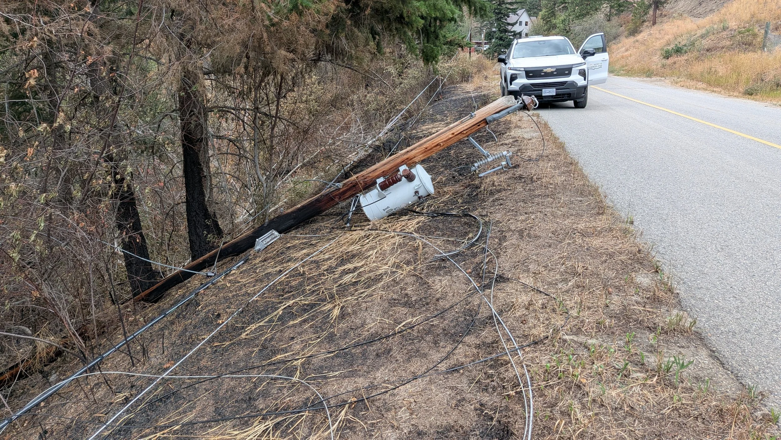





Property owners and their designated representatives can enter specific Bald Range wildfire-affected properties under a Prohibit Entry Order, while general visiting and occupancy remain prohibited as post-fire hazards and recovery work continue.