Area restriction issued near Poplar Creek wildfire
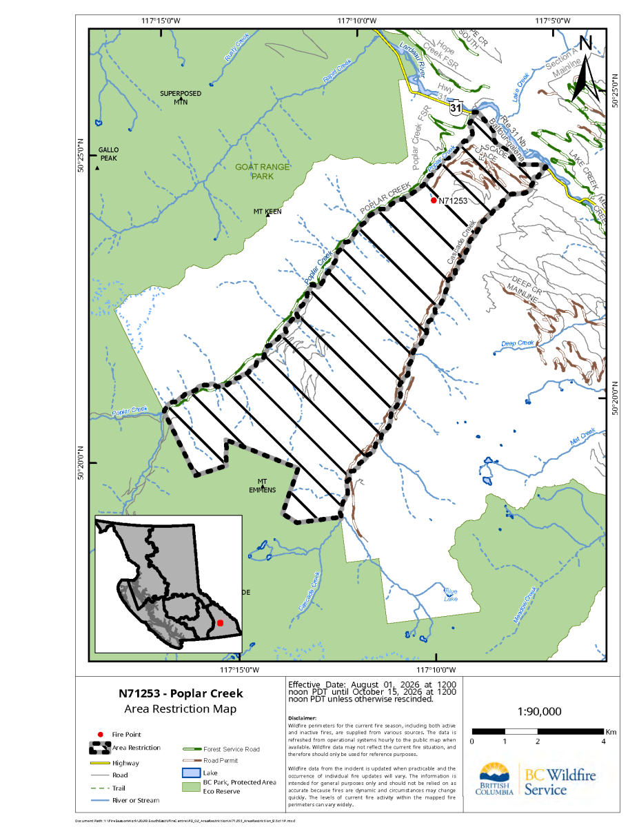
An area restriction is now in effect around the Poplar Creek wildfire, approximately 20 kilometres northwest of Meadow Creek.
The BC Wildfire Service estimates the fire, identified as N71253, at 53 hectares.
The restriction took effect at noon on Aug. 1 and is scheduled to remain in place until noon on Oct. 15, 2026, unless it is rescinded earlier. The order is intended to protect the public and wildfire personnel working in the area.
The restricted zone covers Crown land between Highway 31, Cascade Creek, the Goat Range Provincial Park boundary and Poplar Creek. Access to private property remains permitted.
People may enter the restricted area only under limited circumstances, including travelling to or from a principal residence that is not under an evacuation order, using a highway, acting in an official capacity or supporting wildfire suppression and enforcement activities.
Anyone who enters or remains in the restricted area without authorization could receive a $1,150 violation ticket.
Restrictions may change depending on fire activity. Current information is available through the BC Wildfire Service website, wildfire map and mobile app.
Wildfires, unattended campfires and open burning violations can be reported by calling 1-800-663-5555, dialing *5555 from a cellphone or using the BC Wildfire Service app.


Grizzly Discoveries Inc. is seeking to raise up to $2 million as the company continues fall exploration across its Greenwood-area properties and prepares for drilling planned between October and December.